| Formats | JPG, PDF, SVG, AI |
| Resolution | 300dpi |
| Dimensions | 300dpi: 5000 x 3750 px |
| Version | 1.2 |
Introducing the United States labeled map, the ultimate digital download resource for educators, students, and geography enthusiasts alike. This simple and comprehensive map serves as an invaluable tool for teaching and learning about the geographical and political landscape of the USA.
Key Features of the United States Labeled Map
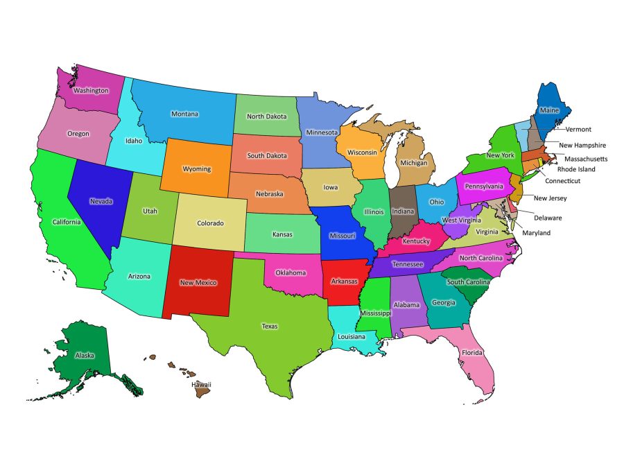
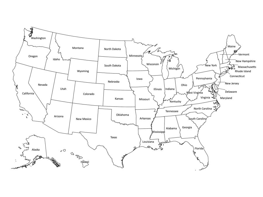
- Two Distinct Versions: Whichever file format you choose, you will have access to a colored as well as a black and white map.
- Multiple File Formats: JPEG (300dpi), PDF, SVG, and AI (Adobe Illustrator) for versatile use.
- High-Resolution Images: Clear and detailed maps with dimensions of 5000 x 3750 px for 300dpi.
- Print-Ready Files: Designed for hassle-free printing, compatible with any home or school printer.
- Scalable Vector Graphics: AI and SVG formats for resizing without losing quality, ideal for editing.
- Instant Digital Download: Quick access to all formats for immediate integration into your teaching materials.
- Comprehensive State Labels: Every state is clearly labeled, facilitating easy identification and learning.
- Student-Centric Design: Easy-to-read labels and state boundaries tailored for student comprehension.
Engaging Color and Classic Black & White Versions
Our United States labeled map comes in two distinct versions to cater to various teaching methods and personal preferences. The vibrant colored map enhances engagement and helps to visually distinguish between states, making it an excellent choice for younger students or visual learners. On the other hand, the black and white version serves as a cost-effective solution for mass printing and personalization, ideal for worksheets and tests.
High-Quality Formats for All Needs
Available in multiple file formats including JPEG (300dpi), PDF, SVG, and AI (Adobe Illustrator), our USA map with labels is versatile and adaptable to your specific needs. Whether you’re looking for a quick printable US map for a pop quiz or a high-resolution file for graphic design projects, we have you covered.
JPEG: Ready-to-Print Convenience
With a high-resolution version at 5000 x 3750 px for 300dpi, our JPEG files are perfect for both small handouts and large posters. They offer clear visibility for, ensuring that each state label and boundary is readable and distinct.
SVG and AI: Scalability Without Quality Loss
For those who require scalability for various projects, the SVG and AI formats are ideal. They allow for infinite resizing without any degradation in quality, making them perfect for everything from small screen displays to large classroom wall maps.
Designed with Educators and Students in Mind
This USA political map is meticulously crafted with teachers and students in mind. It serves as a great reference point for social studies, history, and geography lessons. The clear labeling of each state encourages memorization and easy identification, fostering a hands-on learning experience that is both fun and effective.
Classroom-Friendly
Our US map with states is not only a teacher’s ally but also a student favorite. The high-quality, downloadable map of the USA is a resource that can be utilized for a wide array of educational activities, from creating interactive assignments to serving as a reference for student-led presentations.
A Must-Have for Any Learning Environment
The United States labeled map is a must-have digital asset for any classroom, homeschool, or educational setting. Its adaptability makes it suitable for interactive whiteboards, student tablets, and printed handouts, ensuring that the learning process is engaging and comprehensive.
Easy Access for Instant Use
Purchasing the map grants you immediate access to your file, allowing you to integrate this resource into your curriculum, or project without any delay. Simply choose your preferred format, download, and you’re ready to go!

Ines –
Useful resource
Jennifer H. –
Excited to use for College Decision Day!