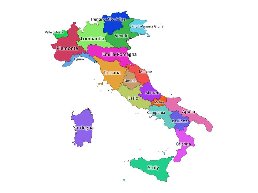
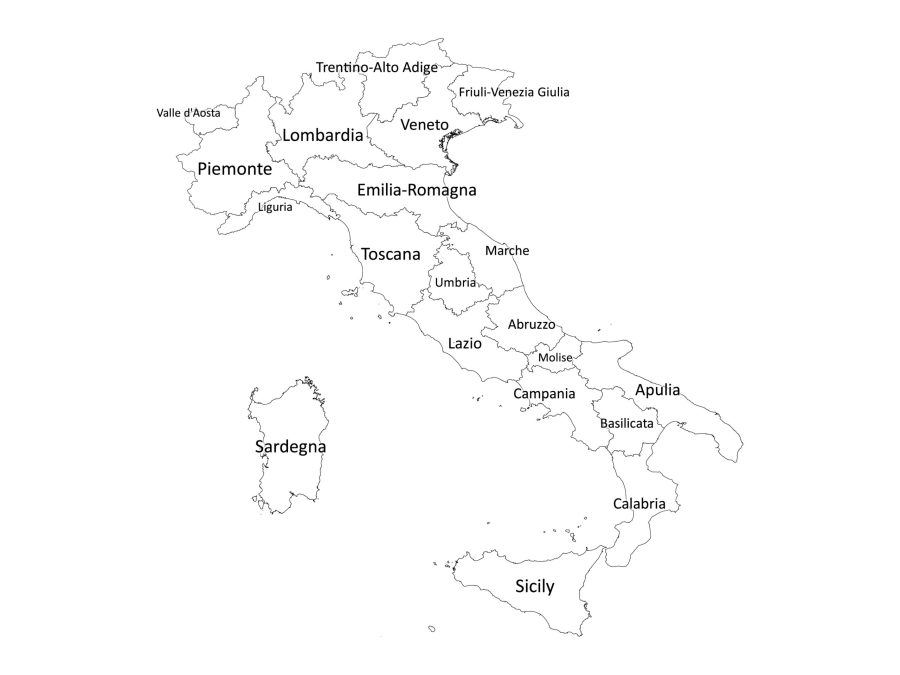
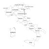
Looking for a comprehensive and detailed map of Italy? Look no further than our Labeled Map of Italy, available for download today! This digital map features all of Italy’s regions clearly labeled for easy reference, making it the perfect tool for anyone studying Italian geography, planning a trip to Italy, or just looking to learn more about this beautiful country.
Available in both black and white and color versions, this map is suitable for any purpose. Whether you need a clear and concise reference tool for your studies or a beautiful and eye-catching decoration for your home or office, our Labeled Map of Italy has got you covered.
Which file formats does our Labeled map come in?
Our Labeled Map of Italy is available in a variety of file formats to suit your needs. Whether you prefer PDF, JPG, PNG, SVG, or AI, we have got you covered. All of these file formats are included in one zip file, making it easy for you to choose the format that works best for you.
PDF: Perfect for printing or sharing digitally, our PDF format is high-quality and easy to use. You can print the map out in a variety of sizes and resolutions to suit your needs, or simply share it digitally with others.
JPG: Ideal for use on websites or in digital presentations, our JPG format is lightweight and easy to load. You can use it to create beautiful and eye-catching visuals that will engage your audience.
PNG: Similar to JPG, our PNG format is ideal for use on websites or in digital presentations. It offers a transparent background, making it easy to overlay the map onto other images or graphics.
SVG: If you need a scalable vector graphic format, our SVG format is the perfect choice. It offers high-quality images that can be scaled up or down without losing quality, making it ideal for use in print or digital applications.
AI: Our AI format is perfect for designers and other creative professionals who need to make customizations to the map. This file format is fully editable, allowing you to make changes to the map to suit your specific needs.
How to download our labeled map
To download the map, please follow these simple steps:
- Add the digital map to your cart and proceed to checkout.
- Enter your payment details and complete the purchase.
- After your payment is processed, you will receive an email with a link to access your account. Within the account page, you should find a link to download the map of Italy
About Italy
Location of Italy on the World Map
Italy is located in southern Europe and is surrounded by the Mediterranean Sea to the south and the Adriatic Sea to the east. Its neighbors include France to the west, Switzerland and Austria to the north, and Slovenia to the northeast. Italy is also located in close proximity to the countries of North Africa and the Middle East, making it a popular destination for tourists and a hub of international trade.
Number of Regions in Italy
Italy is divided into 20 regions. These regions include:
- Abruzzo
- Basilicata
- Calabria
- Campania
- Emilia-Romagna
- Friuli-Venezia Giulia
- Lazio
- Liguria
- Lombardia
- Marche
- Molise
- Piemonte
- Puglia
- Sardegna
- Sicilia
- Toscana
- Trentino-Alto Adige
- Umbria
- Valle d’Aosta
- Veneto
What is the Size of Italy?
Italy has a total area of 301,338 square kilometers (116,347 square miles), making it slightly larger than the US state of Arizona. Italy’s coastline is 7,600 kilometers (4,722 miles) long, and it has a varied geography that includes mountains, plains, and coastal regions. The highest peak in Italy is Mont Blanc, which is located on the border between Italy and France and is the highest peak in the European Union.
The Population of Italy
As of 2021, Italy has a population of approximately 60 million people. The population is concentrated in urban areas, with the majority living in the northern regions of the country. The largest cities in Italy include Rome, Milan, Naples, Turin, and Palermo. Italian society is characterized by its strong family ties and its rich cultural heritage, which is reflected in its language, food, and art.
The official language of Italy
The official language of Italy is Italian. It is spoken by the majority of the population, and it is also recognized as a minority language in some neighboring countries, such as Switzerland, Croatia, and Slovenia. Italian is a Romance language that is derived from Latin, and it has been the primary language of Italy since the unification of the country in 1861. In addition to Italian, there are also several regional languages and dialects spoken throughout Italy, such as Sicilian, Neapolitan, and Sardinian, among others.

Reviews
There are no reviews yet