| Formats | JPG, PDF, SVG, AI |
| Resolution | 180dpi, 300dpi |
| Dimensions | 180dpi: 3000 x 2250 px 300dpi: 5000 x 3750 px |
| Version | 1.2 |
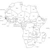
Embark on a virtual journey through the magnificent continent of Africa with our simple digital Africa map download. Our collection, perfect for educational and decorative purposes, offers a detailed view of Africa’s rich geographic and political landscape.
Key Features of the Africa Labeled Map
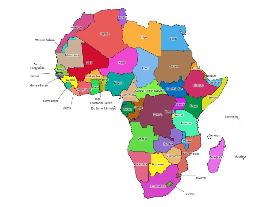
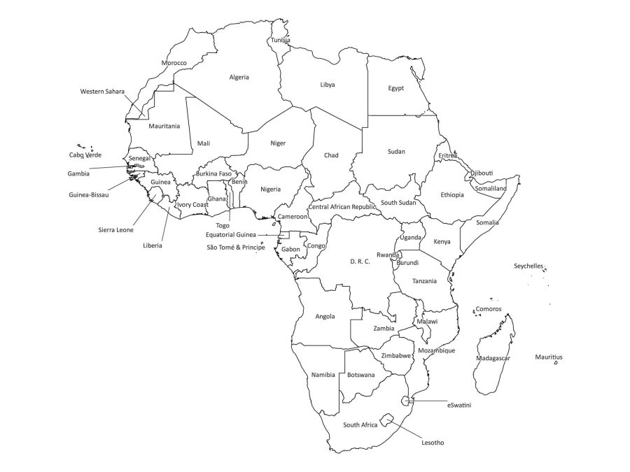
- Two Visual Versions: Comes in a colored version to easily distinguish between countries and the sleek black and white version for a classic look.
- Multiple File Formats: Availability in a variety of file formats, including:
- JPEG at 180dpi (3000 x 2250 px) for standard resolution.
- JPEG at 300dpi (5000 x 3750 px) for high-resolution needs.
- PDF for easy and convenient printing.
- SVG for scalable graphics without quality loss.
- AI (Adobe Illustrator) for customizable vector graphics.
- Educational Tool: Perfect for teaching and learning, with clear labels for all countries, making it a highly educational map of Africa.
- Printable: Both the color and black and white maps are ready-to-print, suitable for creating wall posters, handouts, or booklets for educational purposes.
- High Resolution: Crisp, detailed images that retain clarity even when scaled up, ideal for both digital and print use.
- Instant Download: Access your maps right after purchase with no waiting period.
- Wide Application: Use for academic learning, decorating spaces, travel planning, or as a geographical reference tool.
- User-Friendly: Simple and intuitive design, making it easy to read and understand, even for young learners.
- Digital and Versatile: Ideal for use in digital presentations or online teaching resources, with the flexibility to be incorporated into various digital platforms.
Educational Map of Africa
Our digital Africa map comes in two distinct versions to cater to a variety of needs and preferences: a vibrant, colored version that captures the diversity of the continent, and a classic black and white version for a more traditional or formal look. This educational map of Africa serves as an excellent resource for teachers, students, and geography enthusiasts to explore the countries and regions of Africa with ease.
High-Resolution Africa Map with Countries
The high resolution map of Africa provides crisp, clear visuals for both print and digital use. With dimensions of 3000 x 2250 px at 180dpi and a high-definition version of 5000 x 3750 px at 300dpi, these maps ensure that every country and boundary is visible and distinct. The labeled map of Africa displays each country’s borders and names, making it an ideal tool for learning and reference.
Versatile File Formats for Any Use
Our printable map of Africa is not just restricted to on-screen learning; it’s designed to be versatile. Available in multiple file formats including JPEG (180dpi and 300dpi for optimal clarity), PDF for easy printing, SVG for scalability without loss of quality, and AI (Adobe Illustrator) for those who wish to customize or scale the map for specific projects. This ensures that whether you need a simple Africa map for a quick reference or a vector map of Africa for design purposes, you have the right format at your fingertips.
Simple Africa Map for All Ages
The simplicity of our Africa geography map is its strength. It provides a straightforward, easy-to-understand representation of Africa’s geography that is suitable for users of all ages. Whether it’s for a school project or to decorate your space with meaningful art, this simple Africa map balances aesthetic appeal with functionality.
Digital Africa Map: A Tool for Exploration and Learning
In our digital age, having resources that are both accessible and high-quality is essential. Our digital Africa map offers just that – a convenient and high-resolution tool to explore the wonders of Africa. It’s not just a map; it’s a gateway to understanding the vast landscapes and countries that make up this incredible continent.
Ideal for a Wide Range of Projects
Whether you’re a teacher looking to bring your geography lessons to life, a student working on an Africa-related project, or a traveler planning your next adventure, this map is the perfect companion. Its high quality makes it suitable for printed posters, classroom decorations, or as a handy reference in your travel kit.
Instant and Convenient Download
Getting your hands on this map is as simple as a few clicks. Choose your preferred version, select your format – be it Africa map pdf, Africa map svg, or the editable AI file – and download it instantly. No waiting, no shipping fees, just instant access to a map that will serve you for years to come.
Purchase and Usage
Our Africa Labeled Map is available for immediate download upon purchase. We’ve ensured that the process is quick, allowing you to access the map and utilize it for your personal, educational, or commercial projects without any hassle.
Start your exploration of Africa with our meticulously crafted maps. Discover the continent’s geography in stunning detail and clarity, and let the learning begin. Purchase your digital download today and dive into the rich tapestry that is Africa.
Reviews
There are no reviews yet