| Formats | JPG, PDF, SVG, AI |
| Resolution | 180dpi, 300dpi |
| Dimensions | 180dpi: 3000 x 2250 px 300dpi: 5000 x 3750 px |
| Version | 1.1 |
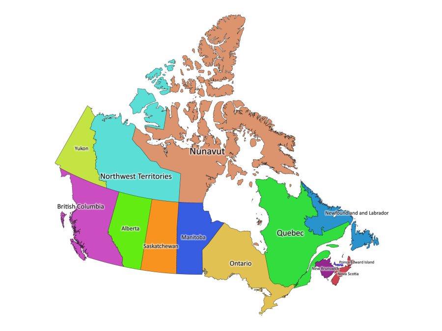
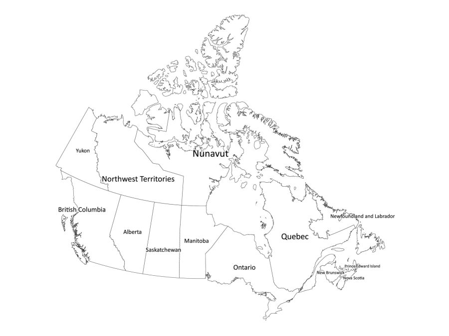
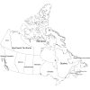
Canada is a vast country, spanning from the Pacific to the Atlantic Ocean and northward to the Arctic. It is the second-largest country in the world, after Russia, and is divided into thirteen provinces and territories. Our downloadable labeled map of Canada can be a useful resource for anyone looking to study Canada’s geography.
Features of the Labeled Map of Canada
The labeled map of Canada digital map is a high-quality, downloadable map that comes in both black and white and colored versions. It is available in several file formats, including PDF, JPG, SVG, and AI. This means that you can choose the format that works best for your needs and preferences. Here are some of the features of our labeled map of Canada:
- Clear labeling: Each province and territory is labeled clearly, making it easy to identify and locate them.
- High-quality graphics: The digital map features high-quality graphics, making it easy to read. Whether you’re printing it out or using it on your computer, you can be sure that the map will be clear and easy to read.
- Multiple file formats: The labeled map of Canada digital map is available in several file formats, including PDF, JPG, SVG, and AI. This means that you can choose the format that works best for your needs and preferences.
- Customizable: The digital product is fully customizable, allowing you to change the colors, labels, and other features to suit your needs and preferences.
How to edit our Labeled map of Canada
If you would like to edit the map, we suggest making use of the AI or SVG file which are vector-based formats that are ideal for editing. Here are the steps to edit:
- Open the file in your preferred vector graphics editor, such as Adobe Illustrator, CorelDRAW, or Inkscape (The AI file can only be opened using Adobe Illustrator)
- Select the layer that you want to edit. Each province or territory will be on a separate layer, which makes it easy to edit individual sections of the map.
- Use the editing tools in the software to make the desired changes. For example, you can change the color of a province or territory, add text labels, or modify the thickness of the borders.
- If you need to add or remove layers from the map, use the Layers panel in your software to manage the layers.
- Once you have made all the necessary changes, save the edited file or export to other file formats.
About Canada
Where is Canada on the world map?
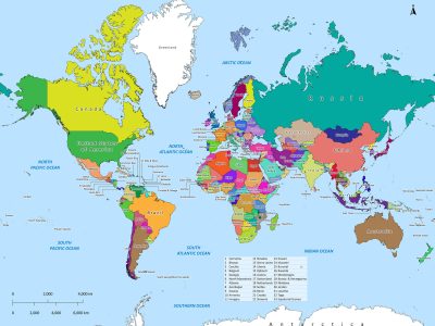
Canada is located in the northern part of the North American continent. It is bordered by the United States to the south, the Arctic Ocean to the north, the Atlantic Ocean to the east, and the Pacific Ocean to the west. Canada is the second-largest country in the world by land area, covering approximately 9.98 million square kilometers.
Canada’s Level One Administrative Divisions
Canada is divided into thirteen provinces and territories, each with its own unique culture, geography, and economy. Here is a list of Canada’s level one administrative divisions, along with whether they are a province or territory:
- Alberta (Province)
- British Columbia (Province)
- Manitoba (Province)
- New Brunswick (Province)
- Newfoundland and Labrador (Province)
- Northwest Territories (Territory)
- Nova Scotia (Province)
- Nunavut (Territory)
- Ontario (Province)
- Prince Edward Island (Province)
- Quebec (Province)
- Saskatchewan (Province)
- Yukon (Territory)
The population of Canada
As of 2021, the estimated population of Canada is approximately 38.1 million people. The population is spread out across the country, with the majority living in urban areas such as Toronto, Vancouver, and Montreal. The indigenous population of Canada makes up approximately 5% of the total population.
The size of Canada
Canada is the second-largest country in the world, covering approximately 9.98 million square kilometers. It is a vast country that spans multiple time zones and features a diverse range of landscapes, from towering mountains to vast prairies, from rugged coastlines to dense forests.
The Culture and History of Canada
Canada has a rich and diverse culture that is shaped by its history and geography. The country has a long and complex history that includes both Indigenous and European influences.
Indigenous Peoples
Indigenous peoples have lived in Canada for thousands of years and have a deep connection to the land. They have their own languages, cultures, and traditions that have been passed down through generations. Canada’s Indigenous population is diverse and includes First Nations, Inuit, and Métis peoples.
European Settlement
Europeans first arrived in Canada in the late 15th century, with the arrival of Norse explorers. However, it was not until the 16th century that the French and English began to establish permanent settlements. The French settled in what is now Quebec, while the English established colonies in what is now Nova Scotia and Newfoundland.
Over time, more Europeans arrived in Canada, and the country became a destination for immigrants from all over the world. Today, Canada is known for its multiculturalism and is home to people from many different cultural backgrounds.
Arts and Culture
Canada has a vibrant arts and culture scene, with a rich tradition of music, literature, and visual arts. The country is home to many talented artists and has produced world-renowned musicians, writers, and artists.
One of the most famous Canadian artists is Tom Thomson, who is known for his landscape paintings of the Canadian wilderness. Other notable Canadian artists include Emily Carr, Lawren Harris, and the Group of Seven.
In addition to the visual arts, Canada is also known for its literature, with many famous Canadian authors such as Margaret Atwood, Alice Munro, and Michael Ondaatje.
Reviews
There are no reviews yet