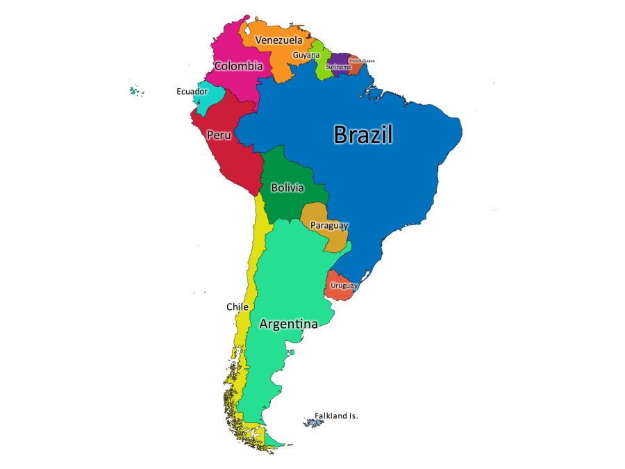
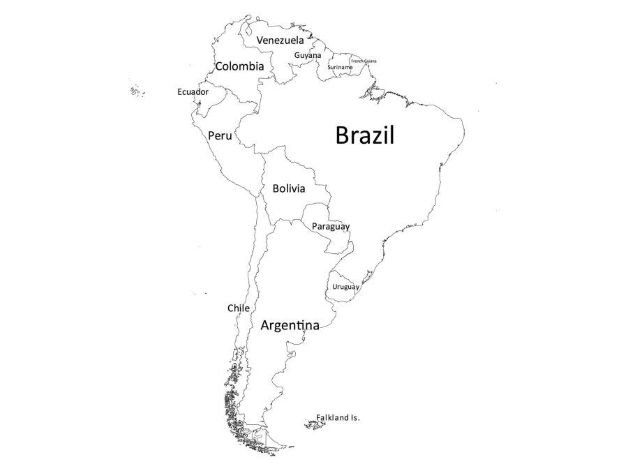
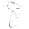
Looking for a high-quality, map of South America that shows all of the countries and their borders? Look no further than our Labeled Map of South America! Our downloadable digital map is perfect for anyone who wants an accurate representation of the continent, whether you’re a student studying geography, a researcher, or a teacher looking for educational materials.
Features of the Labeled Map of South America
Accurate and Detailed Map
Our labeled map of South America is a comprehensive and accurate representation of the continent. All of the countries are clearly labeled, and the map is up to date with the most recent border changes.
Two Versions Available
We understand that different people have different needs, so we offer two versions of our map: a black and white version and a colored version. The black and white version is perfect for printing out and using for coloring activities, while the colored version is ideal for digital use or for those who want a quick reference guide.
The Map comes in Multiple File Formats
Our Labeled Map of South America is available in multiple file formats, including PDF, JPG, PNG, SVG, and AI. This means that you can use the map in a variety of ways, from printing it out and using it in the classroom to incorporating it into your digital projects. We bundle all the formats in a single zip file for your convenience.
Easy to Use
Our labeled map of South America is easy to use, whether you’re a seasoned map user or a beginner. The map is designed with clarity and simplicity in mind, so you can easily find the information you need.
Is the South America Labeled Map Editable?
Yes, our labeled map of South America is editable. We provide the map in a variety of file formats all bundled in a zip file. These file formats are compatible with a wide range of design and editing software including Adobe Illustrator, Inkscape, and Figma. We especially recommend the SVG or AI files for this purpose.
With these files, you can easily customize the map to suit your specific needs, whether you want to add or remove features, change the colors, or modify the labels. With our editable labeled map of South America, you have the flexibility to create your own unique maps and designs for a variety of purposes.
About South America
Where is South America on the world map?
South America is located in the southern hemisphere of the world, primarily in the western hemisphere. It is bordered by the Pacific Ocean to the west and the Atlantic Ocean to the east. South America is connected to North America by the Isthmus of Panama, which forms the land bridge between the two continents.
The equator runs through the northern part of the continent, with most of the landmass located south of the equator. To locate South America on a world map, you can look for the large landmass in the southern hemisphere between North America and Antarctica.
List of Countries in South America
Here’s a list of all the countries in South America, along with their capital cities:
- Argentina – Buenos Aires
- Bolivia – La Paz, Sucre
- Brazil – Brasília
- Chile – Santiago
- Colombia – Bogotá
- Ecuador – Quito
- Guyana – Georgetown
- Paraguay – Asunción
- Peru – Lima
- Suriname – Paramaribo
- Uruguay – Montevideo
- Venezuela – Caracas
Is French Guiana a Country?
French Guiana is not a country, but rather an overseas department and region of France. It is located on the northern coast of South America, bordered by Brazil to the south and Suriname to the west. French Guiana is an integral part of the French Republic and is governed by French laws and institutions. As a department of France, it uses the euro as its currency.
While it is not a sovereign state, it is included on many maps of South America due to its location on the continent.
Other Interesting Facts about South America
South America is the fourth largest continent in terms of land area. It covers approximately 17.84 million square kilometers and is home to over 430 million people.
South America is also known for its incredible biodiversity. The Amazon rainforest, located in Brazil, is the largest rainforest in the world and is home to a wide range of plants and animals. In fact, scientists estimate that the Amazon rainforest is home to around 10% of the world’s known species.
South America is also home to some of the most iconic landmarks in the world, including the Andes Mountains, Angel Falls in Venezuela, and the Galapagos Islands in Ecuador.
The continent is rich in culture and history, with indigenous peoples dating back thousands of years and a vibrant blend of European, African, and indigenous cultures.
Reviews
There are no reviews yet