| Formats | JPG, PDF, SVG, AI |
| Resolution | 180dpi, 300dpi |
| Dimensions | 180dpi: 5000 x 3926 px 300dpi: 8334 x 6542 px |
| Version | 1.2 |
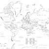
Embark on a global journey from the comfort of your own home or classroom with our comprehensive Labeled World Map. Ideal for students, educators, and geography enthusiasts alike, this Digital World Map is not only a tool for learning but also a captivating visual experience. Dive into the intricate details of our planet with this High Resolution World Map, meticulously labeled to enhance your understanding of world geography.
Key Features:
For a quick overview of what our Labeled World Map offers, here’s a concise list of the main product details:
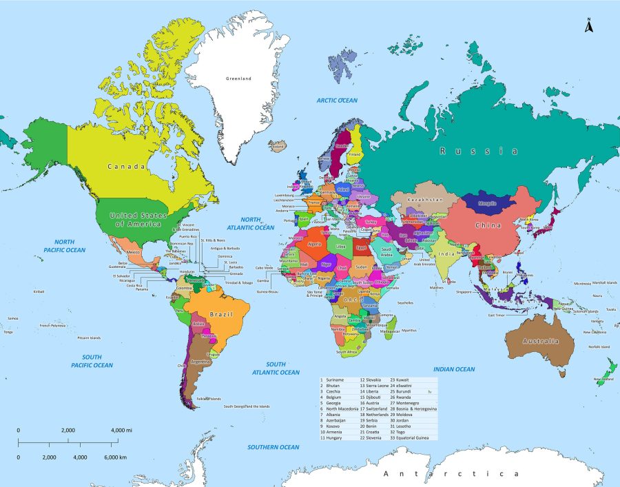
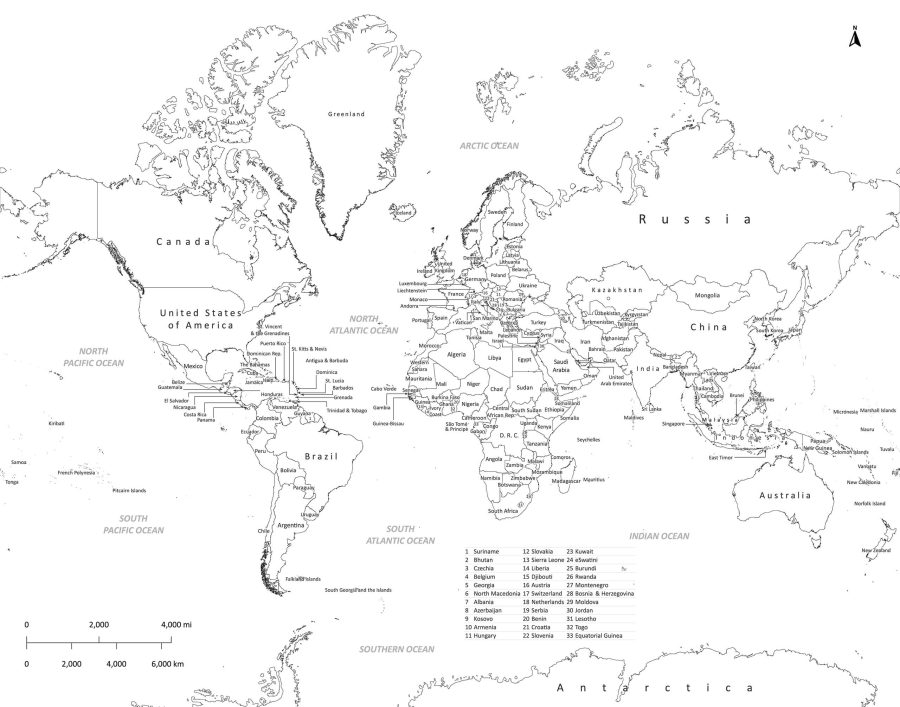
- Two Visual Styles: All our maps come in black and white as well as colored versions – whichever file format you choose.
- Multiple File Formats:
- JPEG – Standard for easy viewing on all devices, provided in both 180dpi (5000 x 3926 px) for standard use and 300dpi (8334 x 6542 px) for high-quality prints.
- PDF – Ideal for straightforward printing and sharing.
- SVG – This is a vector graphic with infinite scaling.
- AI (Adobe Illustrator) – Perfect for customization and professional use.
- High Resolution:
- 180dpi with dimensions of 5000 x 3926 pixels – ensures clear and crisp imagery for smaller prints and digital use.
- 300dpi with dimensions of 8334 x 6542 pixels – provides impeccable detail for large prints and detailed examination.
- Instant Download: Access your digital map immediately after purchase—no waiting necessary.
- Educational and Decorative: An informative tool for educators and students, and a decorative asset for travelers and enthusiasts.
- Fully Labeled: Every country is accurately labeled for easy identification and reference.
- Global Coverage: Every recognized country is featured, making this a comprehensive world geography resource.
- Versatile Use: Whether for education, reference, decor, or project planning, this map suits a multitude of needs.
- Easy to Print: Print at home or through a professional service with our print-ready files.
The Ultimate Educational Tool: World Map for Education
With a clear and accurate representation of all the countries, this World Map with Countries serves as an exceptional educational resource. The Printable World Map format is perfect for interactive learning sessions, allowing educators and students to explore the globe’s vast geography effortlessly.
High-Quality Imagery: High Resolution World Map
Available in both vivid colors and a sleek black and white version, our maps cater to different aesthetic preferences while maintaining the highest level of detail. Each map is offered in multiple file formats: JPEG (180dpi and 300dpi), PDF, SVG, and AI (Adobe Illustrator), ensuring compatibility with various devices and software.
Colored World Map
- Dimensions: 5000 x 3926 px (180dpi) / 8334 x 6542 px (300dpi)
- Formats: JPEG, PDF, SVG, AI
Black and White World Map
- Dimensions: 5000 x 3926 px (180dpi) / 8334 x 6542 px (300dpi)
- Formats: JPEG, PDF, SVG, AI
Versatile and User-Friendly: Digital World Map
Whether you need a map for a professional presentation or a craft project, our Digital World Map has you covered. The digital formats allow for easy printing and manipulation, so you can scale and edit the map as needed without losing clarity. The World Map PDF version is especially suitable for quick printing and distribution, making it a breeze to share with others.
Perfect for Decor and Practical Use: Printable World Map
Not only educational but also decorative, this World Map Download can adorn the walls of your home, office, or classroom, serving as a constant source of knowledge and inspiration. The Labeled Map of the World in high resolution is print-ready, allowing you to create large-scale maps that can act as statement pieces in any room.
For Every Map Enthusiast: Geography Map
Whether you are a seasoned geographer or a curious mind looking to delve into the wonders of our planet, this World Geography Map offers an in-depth look at political borders, country names, and other geographical details. It’s an invaluable asset for anyone with a thirst for knowledge about the world’s layout.
Instant Access: World Map Download
Gain immediate access to this rich source of geographical information with our easy World Map Download process. Upon purchase, you can download the files instantly and begin your exploration without any delay.
Conclusion
Our Labeled World Map is a versatile, high-quality product designed to meet the needs of anyone looking for a detailed and accessible world map. With instant access and a variety of formats available, it’s the perfect addition to your digital collection for reference, education, or decoration. Download your map today and start exploring the world in all its splendor!
steven –
just what I needed, thank you
James Miller –
Love the black & white option