| Formats | JPG, PNG, PDF, SVG, AI |
| Resolution | 300dpi |
| Size | 3600 x 2700 px; 37.5 x 28.13 inches; 95.3 x 71.4 cm |
| Version | 1.1 |
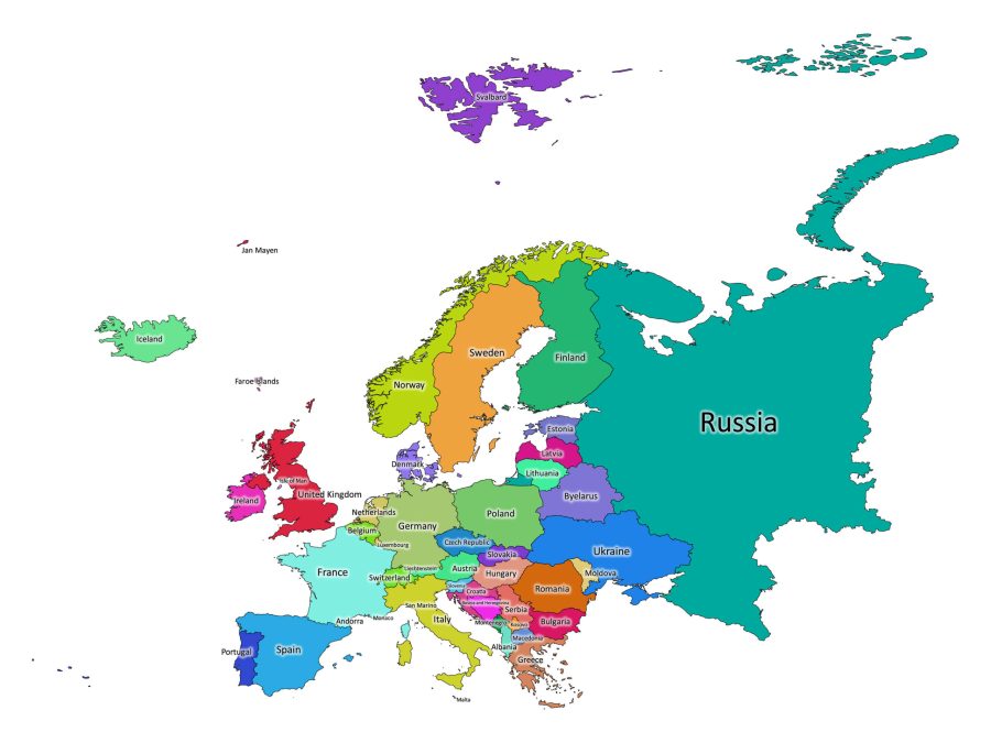
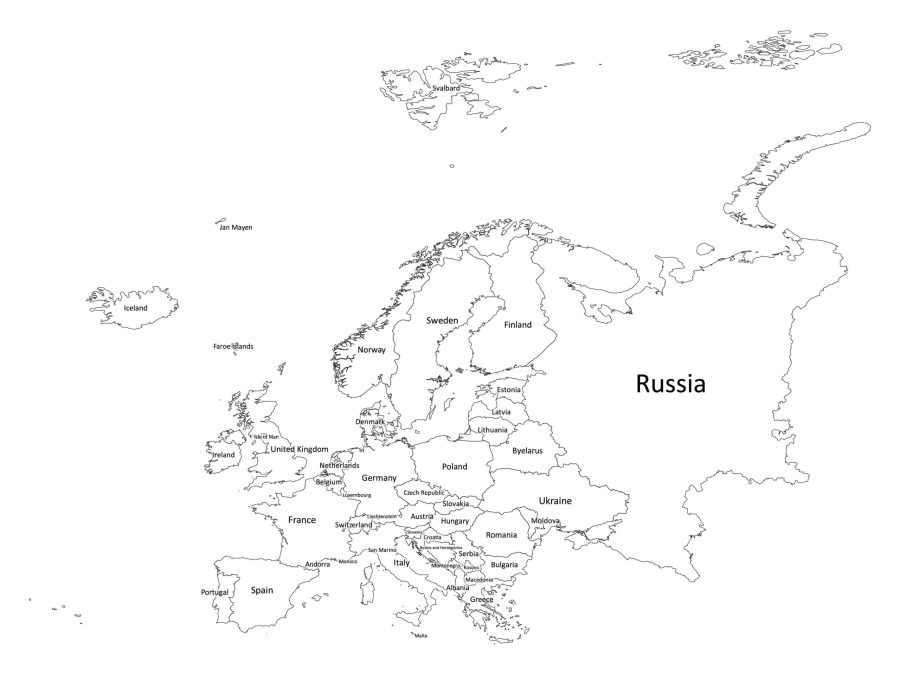
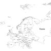
Looking for a comprehensive and informative labeled map of Europe? Look no further than our high-quality digital map, available for download now. With clear labeling and accurate country boundaries, this map is the perfect resource for anyone seeking to learn more about Europe and its diverse countries.
About our labeled map of Europe
Our labeled map of Europe is available in both black and white and color versions, giving you the flexibility to choose the style that best suits your needs. And with a range of file formats to choose from, including PDF, JPG, PNG, SVG, and AI, you can be sure that our map will work seamlessly with your existing digital tools and workflows.
Accurate and Up-to-Date Information
Our labeled map of Europe is designed with accuracy and completeness in mind. We have carefully researched and labeled each country, ensuring that you have access to the most up-to-date information possible. Whether you are a student, a teacher, or just someone with a passion for geography, this labeled map is for you.
Easy to Use and Customize
Our labeled map of Europe is incredibly user-friendly. Whether you are working on a research project, creating a presentation, or just looking to learn more about the continent, our map is designed to be easy to use and customize. With our range of file formats, you can easily import our map into your preferred digital tool and start working with it right away. If you need to make any adjustments or changes, our map is fully customizable, allowing you to add your labels or annotations as needed.
The Labeled map is Available in Multiple Formats
Our labeled map of Europe is available in a range of file formats, making it a versatile resource no matter what your needs are. Whether you prefer to work with PDFs, JPGs, PNGs, SVGs, or AIs, our map is designed to be compatible with your preferred digital tools and workflows. And with all formats bundled together in a convenient zip file, you can be sure that you have everything you need to get started right away.
****
List of countries in Europe
Here is a list of European countries, as shown on our map:
- Albania
- Andorra
- Austria
- Belarus
- Belgium
- Bosnia and Herzegovina
- Bulgaria
- Croatia
- Cyprus
- Czech Republic
- Denmark
- Estonia
- Finland
- France
- Germany
- Greece
- Hungary
- Iceland
- Ireland
- Italy
- Kosovo
- Latvia
- Liechtenstein
- Lithuania
- Luxembourg
- Malta
- Moldova
- Monaco
- Montenegro
- Netherlands
- North Macedonia
- Norway
- Poland
- Portugal
- Romania
- Russia
- San Marino
- Serbia
- Slovakia
- Slovenia
- Spain
- Sweden
- Switzerland
- Ukraine
- United Kingdom (UK)
- Vatican City (Holy See)
Is Russia in Europe or Asia?
Russia is a transcontinental country that spans Eastern Europe and Northern Asia. The majority of its landmass is located in Asia, while a smaller portion(as depicted on our map) lies in Eastern Europe. This part is commonly known as European Russia.
The Ural Mountains are often considered the traditional boundary between Europe and Asia in Russia. The western part of Russia, including cities like Moscow and St. Petersburg, is situated in Europe, while the vast eastern portion extends into Asia.
Facts about the continent of Europe
Europe is a continent rich in history, culture, and diversity. Here are some interesting facts about Europe that you may find fascinating:
- Europe is the second smallest continent in the world, after Australia.
- The highest point in Europe is Mount Elbrus, located in Russia, with a height of 5,642 meters.
- Europe is home to the world’s smallest country, Vatican City, which is also the seat of the Catholic Church.
- Europe is the birthplace of many famous scientists, artists, and musicians, including Leonardo da Vinci, Michelangelo, Johann Sebastian Bach, and Wolfgang Amadeus Mozart.
- The longest river in Europe is the Volga, which flows through Russia and into the Caspian Sea.
- Europe is home to the largest wine-producing region in the world, with France, Italy, and Spain being the top three wine-producing countries.
- The European Union is a political and economic union of 27 member states, which was formed to promote economic cooperation and political stability across the continent.
- Europe has a rich history of sports, with football (soccer) being the most popular sport in many countries.
- The Euro is the official currency of 19 European countries, including France, Germany, Italy, and Spain.
- Europe is a popular tourist destination, with millions of visitors flocking to cities such as Paris, Rome, and Barcelona every year.
Whether you are a student, or just someone with an interest in geography, our labeled map of Europe is the perfect resource for you. With clear labeling and a range of file formats to choose from, our map is designed to be adaptable for a wide range of use cases. So why wait? Download our labeled map of Europe today and start exploring the continent like never before!
Reviews
There are no reviews yet