| Formats | JPG, PDF, SVG, AI |
| Resolution | 300dpi |
| Dimensions | 300dpi: 5000 x 3750 px |
| Version | 1.2 |
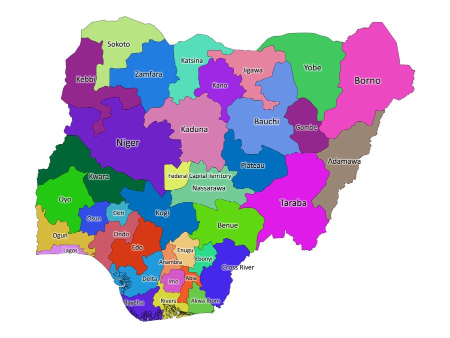
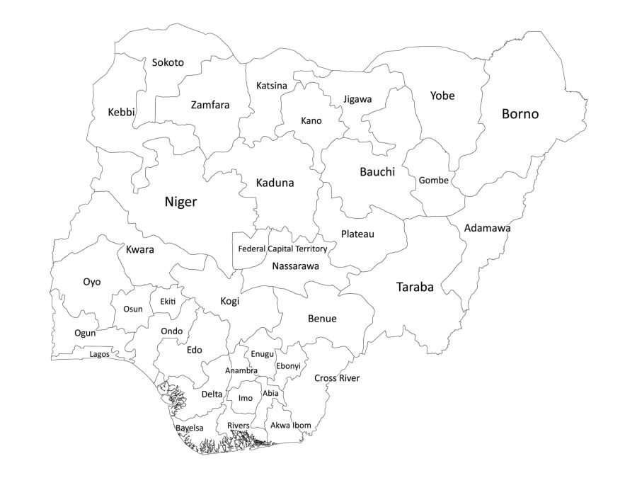
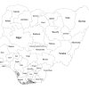
If you’re searching for a comprehensive and accurate labeled map of Nigeria, then you have come to the right place. Our downloadable map shows the country’s states and federal capital territory, with options available in black and white and colored versions. Additionally, we provide the map in a variety of file formats, including PDF, JPG, SVG, and AI, all bundled together in a convenient zip file.
Key Features of Our Labeled Map of Nigeria
Our labeled map of Nigeria boasts several key features that make it a must-have tool for students, teachers, and users alike. These features include:
- Accurate Representation of State Borders and Labels: The map has clearly marked state borders and labels, making it easy to read and use.
- Multiple File Formats: We provide the map in PDF, JPG, SVG, and AI file formats, making it compatible with different software and platforms.
- Regular Updates: We regularly update our map to ensure that it remains accurate and up-to-date.
List of Divisions as shown on our labeled map
Nigeria’s level one administrative divisions are comprised of 36 states and the Federal Capital Territory (FCT), Abuja. The 36 states are:
- Abia
- Adamawa
- Akwa Ibom
- Anambra
- Bauchi
- Bayelsa
- Benue
- Borno
- Cross River
- Delta
- Ebonyi
- Edo
- Ekiti
- Enugu
- Gombe
- Imo
- Jigawa
- Kaduna
- Kano
- Katsina
- Kebbi
- Kogi
- Kwara
- Lagos
- Nasarawa
- Niger
- Ogun
- Ondo
- Osun
- Oyo
- Plateau
- Rivers
- Sokoto
- Taraba
- Yobe
- Zamfara
About Nigeria
Where is Nigeria on the World Map?
Nigeria is located in West Africa and shares borders with Niger, Chad, Cameroon, and Benin. The country has a coastline along the Gulf of Guinea to the south, and it is situated between latitudes 4° and 14°N and longitudes 2° and 15°E.
The Population of Nigeria
Nigeria is Africa’s most populous country and the seventh most populous in the world, with an estimated population of over 211 million people. The country is home to over 250 ethnic groups, each with its unique culture and language. The majority of the population is concentrated in the southern part of the country, with Lagos being the most populous city.
The Size of Nigeria
Nigeria is the 32nd largest country in the world, covering a total land area of 923,768 square kilometers. The country stretches over 1,000 kilometers from north to south and over 1,200 kilometers from east to west.
The Culture and History of Nigeria
Nigeria has a rich and diverse culture, with influences from its many ethnic groups and its history as a former British colony. The country is known for its music, art, literature, and film industries, and it has produced globally recognized artists and writers such as Chinua Achebe, Wole Soyinka, and Fela Kuti. Nigeria has a long and complex history, with evidence of human habitation dating back to at least 9000 BCE. The country has experienced periods of colonization, slavery, and military rule, but it has also had periods of great social, economic, and cultural advancement.

Reviews
There are no reviews yet