| Formats | JPG, PDF, SVG, AI |
| Resolution | 300dpi |
| Dimensions | 300dpi: 5000 x 3750 px |
| Version | 1.1 |
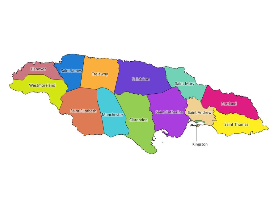
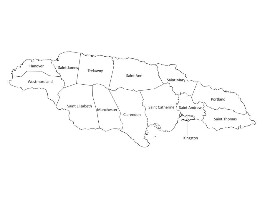
If you have a passion for geography, are a dedicated student, publisher or an educator in search of a precise representation of Jamaica’s administrative structure, look no further than our Labeled Map of Jamaica. This meticulously crafted map details all the parishes of Jamaica, serving as an essential resource for unraveling the geographical nuances of this dynamic Caribbean nation.
Compatible File Formats for Your Convenience
Our labeled map of Jamaica comes in a variety of file formats, ensuring flexibility and ease of use. Choose a suitable file for your need:
- PDF: Ideal for high-quality prints and presentations.
- JPG: Perfect for digital use and online sharing. You can also print the 300dpi version.
- SVG: Scalable Vector Graphics for unlimited zoom without loss of quality. Also great for embedding into HTML documents.
- AI: Adobe Illustrator format for advanced customization.
Get to Know Jamaica’s Parishes
As shown on our map, Jamaica is divided into 14 parishes. Among these parishes is the capital of Jamaica – Kingston, which is located next to St. Andrew parish. Kingston is also the smallest Parish in Jamaica. That being said, let’s take a look at a list of Jamaica parishes:
- Clarendon
- Hanover
- Kingston (Capital)
- Manchester
- Portland
- St. Andrew
- St. Ann
- St. Catherine
- St. Elizabeth
- St. James
- St. Mary
- St. Thomas
- Trelawny
- Westmoreland
How to Edit the Labeled Map of Jamaica
Tailor the Map to Your Preferences
Editing our labeled map is a seamless process. Follow these steps to customize the map according to your preferences:
1. Open the AI file:
Use Adobe Illustrator or a compatible program to access the advanced customization features.
2. Edit text and colors:
Modify labels, adjust colors, or add your information to tailor the map to your specific needs.
3. Save your changes:
Once satisfied with your edits, save the file in your preferred format for easy future access.
Print-Ready
Is Our Labeled Map Printable?
Absolutely! Our labeled map of Jamaica is designed for optimal print quality. Whether you’re creating an educational poster or planning a presentation, the high-resolution PDF and JPG(300dpi) files ensure clarity and detail. Immerse yourself in Jamaica’s vibrant culture with professional-grade prints that capture the essence of each parish.
How You Can Utilize Our Map
Our Jamaica labeled map serves diverse purposes, making it a versatile tool for various needs:
Education and Research:
- Classroom Resource: Enhance geography lessons with a detailed map highlighting Jamaica’s parishes.
- Research Aid: Support academic research with accurate and labeled geographical information.
Business and Publication:
- Publication Use: Our labeled map is suitable for publication, offering a visually appealing and accurate representation of Jamaica’s parishes.
- Presentations: Incorporate the map into presentations to provide a geographical context for business or travel-related discussions.
Download our labeled map of Jamaica today. Whether you’re an educator, researcher, or publisher, our labeled map is an excellent resource for you.

Reviews
There are no reviews yet