| Formats | JPG, PDF, SVG, AI |
| Resolution | 300dpi |
| Dimensions | 300dpi: 5000 x 3750 px |
| Version | 1.2 |
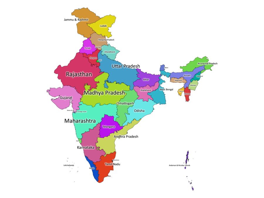
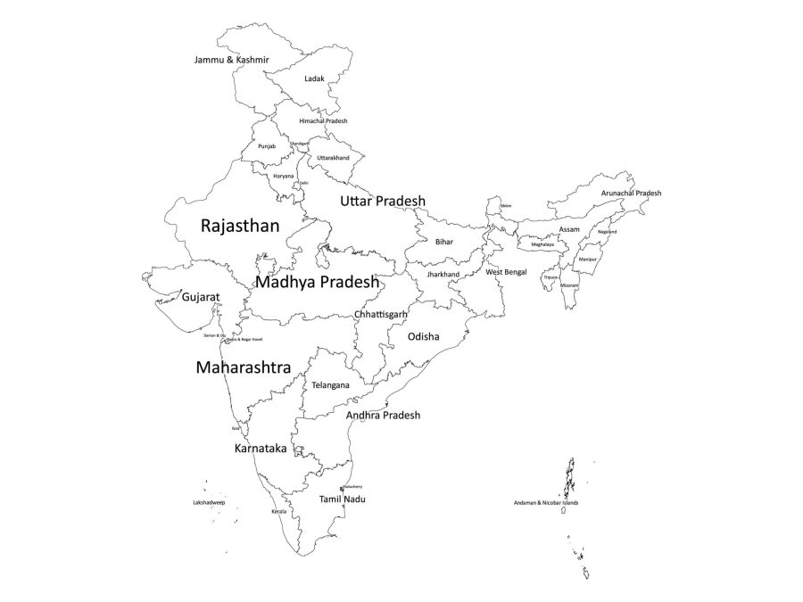
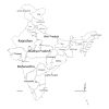
If you’re looking for a comprehensive and informative map of India, our labeled map of India is just what you need. This digital map is perfect for educational and research purposes, providing a clear and accurate representation of India’s states and union territories with clear labeling for easy identification.
About the Labeled Map of India
Available in Black and White and Colored Versions
Our labeled map of India is available in both black and white and colored versions, depending on your preferences. The black and white version provides a classic and elegant look, while the colored version provides a more vibrant and lively feel. You can choose the version that best suits your needs and preferences.
Multiple File Formats Available
To ensure maximum compatibility and versatility, our labeled map of India is available in multiple file formats, including PDF, JPG, SVG, and AI. All these formats are bundled in a single zip file, making it easy for you to download and use the map in your desired format. Whether you need to print it, use it in a presentation, or edit it, you can easily do so using any of these file formats.
About India
The Location of India on the World Map
India is located in South Asia, bordered by Pakistan to the west, China, Nepal, and Bhutan to the northeast, Bangladesh and Myanmar to the east, and the Indian Ocean to the south. Its strategic location has made it a hub for trade and commerce for centuries, with ancient trade routes like the Silk Road passing through the region.
Number of States and Union Territories in India
India is a vast and diverse country, consisting of 28 states and 8 union territories. The states and union territories have their own unique identities and cultures, and they all contribute to the rich tapestry of Indian society. Here is a list of the states and union territories in India, along with their classification as either a state or union territory:
States:
- Andhra Pradesh
- Arunachal Pradesh
- Assam
- Bihar
- Chhattisgarh
- Goa
- Gujarat
- Haryana
- Himachal Pradesh
- Jharkhand
- Karnataka
- Kerala
- Madhya Pradesh
- Maharashtra
- Manipur
- Meghalaya
- Mizoram
- Nagaland
- Odisha
- Punjab
- Rajasthan
- Sikkim
- Tamil Nadu
- Telangana
- Tripura
- Uttar Pradesh
- Uttarakhand
- West Bengal
Union Territories:
- Andaman and Nicobar Islands
- Chandigarh
- Dadra and Nagar Haveli and Daman and Diu
- Lakshadweep
- Delhi
- Puducherry
- Jammu and Kashmir
- Ladakh
The Population of India
India is the second-most populous country in the world, with a population of over 1.3 billion people. The country is home to a diverse range of ethnic groups and religions, including Hindus, Muslims, Sikhs, Christians, Buddhists, and Jains. The population of India is concentrated in urban areas, with the largest cities being Mumbai, Delhi, and Bangalore. India’s population is expected to continue to grow, with projections estimating that it could become the most populous country in the world by 2027.
India’s ethnic groups
According to the Indian government’s census, there are over 2,000 ethnic groups in India, which are classified under various categories such as Scheduled Castes (SC), Scheduled Tribes (ST), Other Backward Classes (OBC), and General Category.
The majority of India’s population belongs to the General Category, which includes a wide range of ethnic groups such as Indo-Aryans, Dravidians, and Tibeto-Burmese. The Indo-Aryan ethnic group is the largest in India, accounting for around 72% of the population, while the Dravidian ethnic group makes up around 25% of the population.
Area Covered by India
India covers an area of approximately 3.29 million square kilometers, making it the seventh-largest country in the world by land area. The country has a diverse range of topography, from the Himalayan mountain range in the north to the coastal plains in the south. India also has a significant coastline, with a total length of over 7,500 kilometers. The country’s natural resources include coal, iron ore, natural gas, and crude oil.
Uses of the Labeled Map of India
Our labeled map of India is a versatile resource that can be used for a wide range of purposes. Here are just a few of the ways in which our map can be used:
- Education: The map is an excellent educational material, providing clear labeling of India’s states and union territories. It can be used in classrooms to help students learn more about the geography and political divisions of India.
- Printing: The map is available in high-quality PDF, JPG, SVG, and AI formats, making it easy to print out in a variety of sizes and formats. It is ideal for use in presentations, reports, and other printed materials.
- Embedding to Websites: The map is also available in a format that can be easily embedded into websites, making it a great tool for bloggers, journalists, and other content creators who want to provide their readers with a visual representation of India’s states and union territories.
Reviews
There are no reviews yet