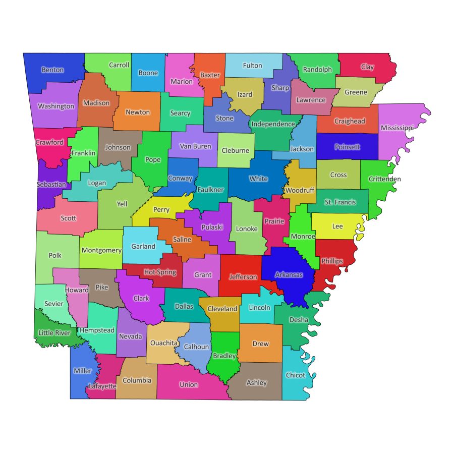
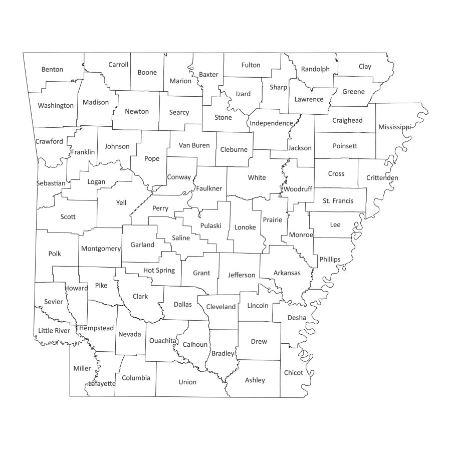
Arkansas labeled map is meticulously designed to provide an extensive overview of the state’s counties. Whether you’re an academic, researcher, or professional, our digital Arkansas labeled map offer valuable insights. Available in black and white and colored versions, this digital product is not just a map; it’s a comprehensive reference tool.
Features
1. Clear County Labels
Explore the intricacies of Arkansas county map with precision. Our labeled map ensures clarity in administrative divisions, making it an invaluable resource for educational, analytical, and research purposes.
2. Dual Versions – Black and White or Colored
Tailor your experience to suit your preferences. Choose between the classic simplicity of the black and white version or the vibrant detailing of the colored map, all while maintaining accuracy in county labels.
3. Multiple File Formats
Adapting to your specific requirements, our Arkansas labeled map is available in various file formats, all bundled conveniently in a zip file:
- PDF: Suitable for detailed prints and presentations.
- JPG and PNG: Ideal for online use and quick reference.
- SVG: Ensures scalability without compromising quality.
- AI (Adobe Illustrator): Allows for advanced customization and editing.
Why Download Our Labeled Map?
1. Educational Insight
Our Arkansas labeled map serves as an excellent educational tool for a nuanced understanding of the state’s county distribution. It’s perfect for students, teachers, and researchers seeking an in-depth perspective.
3. Professional Reference
Professionals in various fields, including designers, can benefit from our labeled map for presentations, reports, and analysis. The map serves as a visual aid for a clearer understanding of Arkansas’s county structure, facilitating effective communication and design applications.
File Formats
1. PDF
Ideal for detailed prints and presentations, the PDF format ensures a high-resolution output, suitable for various professional applications.
2. JPG and PNG
Optimized for online usage, these formats are perfect for quick viewing, sharing on digital platforms, and embedding in documents or websites.
3. SVG
For those requiring scalability without compromising quality, the SVG format is the ideal choice, allowing for customization according to specific needs.
4. AI (Adobe Illustrator)
For graphic designers and advanced users, the AI format provides the flexibility to customize the map extensively, ensuring it aligns perfectly with your requirements.
How to Download Arkansas Labeled Map
- Add to Cart: Click the “Buy now” button to initiate the download process.
- Secure Checkout: Follow the secure checkout process to complete your transaction.
- Download Zip File: Once the transaction is complete, access your zip file containing the map in all available formats.
What is Arkansas Known For?
Rich Cultural Heritage
Arkansas boasts a rich cultural heritage, blending diverse traditions, music, and cuisine. Immerse yourself in the state’s unique blend of Southern hospitality and Ozark mountain charm.
Natural Beauty
Home to picturesque landscapes, Arkansas offers stunning mountains, lush forests, and pristine lakes. Our labeled map helps you appreciate the natural wonders that define the state.
Historical Significance
From the Civil War to the Civil Rights Movement, Arkansas has played a significant role in shaping American history. Explore historic sites and museums to delve into the state’s compelling past.
What is the Capital of Arkansas State?
The capital of Arkansas is Little Rock. Discover the city’s vibrant culture, historic sites, and modern amenities that characterize this dynamic urban center.
What Are All the Cities in Arkansas?
Explore the diverse cities of Arkansas, each with its own unique charm:
- Little Rock
- Fort Smith
- Fayetteville
- Springdale
- Jonesboro
- North Little Rock
- Conway
- Rogers
- Bentonville
- Hot Springs
How to Print Arkansas County Map
If you need a physical copy of your Arkansas county map for professional reference or educational purposes, follow these simple steps:
- Select PDF Format: Opt for the PDF format for detailed and high-quality prints.
- Download and Extract: Download the zip file, extract the PDF file, and open it using a PDF viewer.
- Print Options: Adjust print settings such as paper size, orientation, and color preferences.
- Print: Click on the print button, and you’ll have a detailed Arkansas county map ready for your use.
Our labeled map of Arkansas offer a comprehensive digital resource, allowing you to delve into the intricate details of the state’s counties with ease. Download your preferred version today and unlock a wealth of information about Arkansas’s county structure, culture, and historical significance.


Reviews
There are no reviews yet