| Formats | JPG, PDF, SVG, AI |
| Resolution | 300dpi |
| Dimensions | 300dpi: 5000 x 3750 px |
| Version | 1.2 |
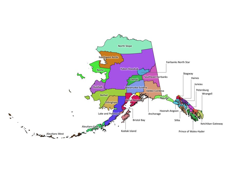
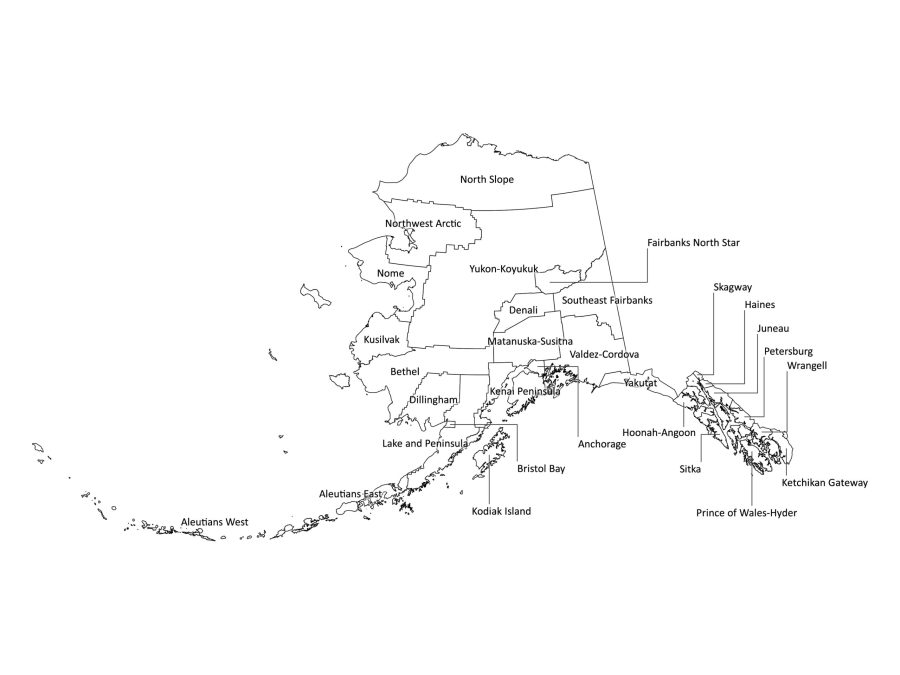
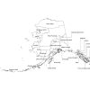
Uncover the intricacies of Alaska with our digital labeled map. Ideal for academic, professional, and research purposes, this downloadable map provides a thorough depiction of Alaska’s boroughs. Available in both Black and White and Colored versions, the map is accessible in various formats, including PDF, JPG, SVG, and AI, conveniently bundled in a single zip file.
Alaska’s Boroughs:
Alaska is divided into 19 boroughs, each representing a distinct facet of the state’s geography and culture. Here is a list of Boroughs in Alaska:
- Anchorage
- Fairbanks North Star
- Matanuska-Susitna
- Kenai Peninsula
- Juneau
- Sitka
- Ketchikan Gateway
- Bethel
- Wasilla
- Barrow
- Bristol Bay
- Nome
- Palmer
- Kodiak Island
- Valdez-Cordova
- North Slope
- Wrangell
- Haines
- Prince of Wales-Hyder
How to Edit the Labeled Map of Alaska:
Customize the map to suit your specific needs effortlessly. Follow these steps to personalize your Alaska labeled map:
- Open the AI file: Utilize Adobe Illustrator or compatible software for advanced customization.
- Edit text and colors: Tailor labels, adjust colors, or include additional information as per your requirements.
- Save your changes: Save the modified file in your preferred format for easy access.
Is Our Labeled Map Printable?
Certainly! Our labeled map of Alaska is designed for optimal print quality. Whether you need a poster-sized map or a standard letter-sized printout for educational purposes, the high-resolution PDF and JPG files ensure clarity and detail.
How You Can Utilize Our Map:
Our Alaska labeled map serves a range of practical purposes, making it a valuable tool for different applications:
Education and Research:
- Classroom Resource: Enhance geography lessons with a detailed map highlighting Alaska’s boroughs.
- Research Aid: Support academic research with accurate and labeled geographical information.
Business and Marketing:
- Market Analysis: Visualize regional data for business planning and market analysis.
- Presentations: Incorporate the map into presentations to provide a geographical context.
FAQs about the state of Alaska
Why Are They Called Boroughs in Alaska?
Alaska chose to name its administrative divisions “boroughs” rather than “counties” due to historical and legal distinctions. The term “borough” aligns with Alaska’s unique political and administrative structure.
When the state was organized in the early 1960s, the framers of the constitution opted for boroughs to reflect the amalgamation of county-like functions with certain municipal powers. This intentional nomenclature choice has persisted, adding a distinctive touch to Alaska’s local governance
Is Alaska Part of the USA or Canada?
Alaska is an integral part of the United States of America. Its status as the 49th state was confirmed on January 3, 1959, following the Alaska Purchase from Russia in 1867. This historic transaction significantly expanded U.S. territory and unlocked Alaska’s vast natural resources.
Who Owned Alaska Before the USA?
Before becoming a U.S. territory, Alaska was under Russian ownership. The Alaska Purchase, completed on March 30, 1867, marked a pivotal moment in history. Despite initial skepticism, the acquisition of Alaska proved to be a wise decision given its abundant resources.
What Is Special About the Aleutian Islands?
The Aleutian Islands, extending westward from the southern tip of the Alaska Peninsula, boast unique features:
- Volcanic Landscape: The islands form part of the Pacific Ring of Fire, showcasing a chain of volcanic peaks.
- Biodiversity: Despite challenging conditions, the Aleutians host a distinctive mix of flora and fauna adapted to their environment.
- World War II History: The Aleutian Islands, particularly Unalaska, played a significant role in World War II, highlighting their historical importance.
- Proximity to Russia: Notably, the Aleutian Islands are in close proximity to Russia, bridging the continents of North America and Asia.
How Close Are Alaska and Russia?
Alaska and Russia are separated by the Bering Strait, with the closest distance being approximately 55 miles (88 kilometers) between Cape Dezhnev in Russia and Cape Prince of Wales in Alaska. This geographical proximity has historical, cultural, and ecological significance, creating a unique connection between the two regions.
How Large Is Alaska Compared to Other States?
Alaska stands as the largest state in the United States, dwarfing others in terms of land area. To put it in perspective, Alaska is larger than the combined area of the next three largest states—Texas, California, and Montana. Its expansive landscapes, diverse ecosystems, and colossal size make Alaska truly stand out on the map.
Dive into the details of Alaska’s boroughs with our meticulously crafted labeled map. Tailored for academic, professional, and research use, this digital download provides an in-depth exploration of the state’s geographical nuances. Download your Alaska labeled map today to access a comprehensive resource that goes beyond exploration, catering to your analytical and informational needs.
Reviews
There are no reviews yet