| Formats | JPG, PDF, SVG, AI |
| Resolution | 300dpi |
| Dimensions | 300dpi: 5000 x 5000 px |
| Version | 1.2 |
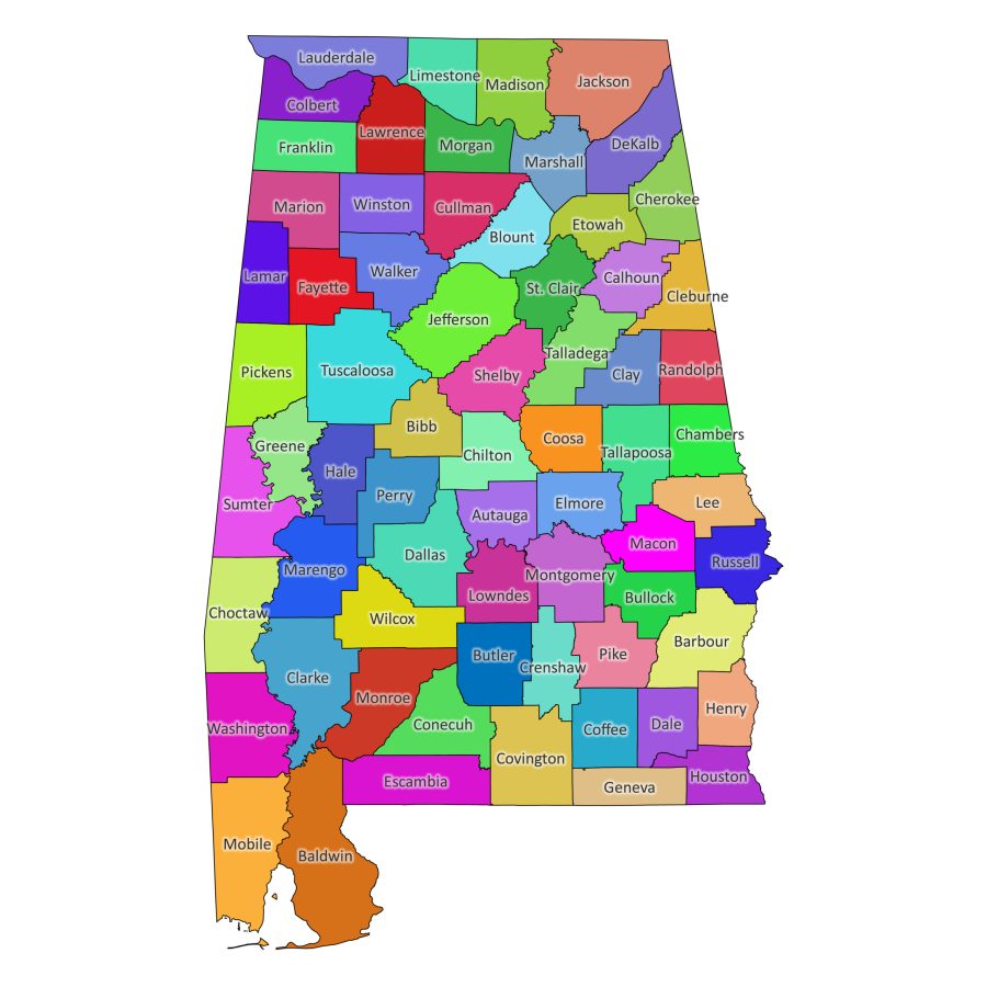
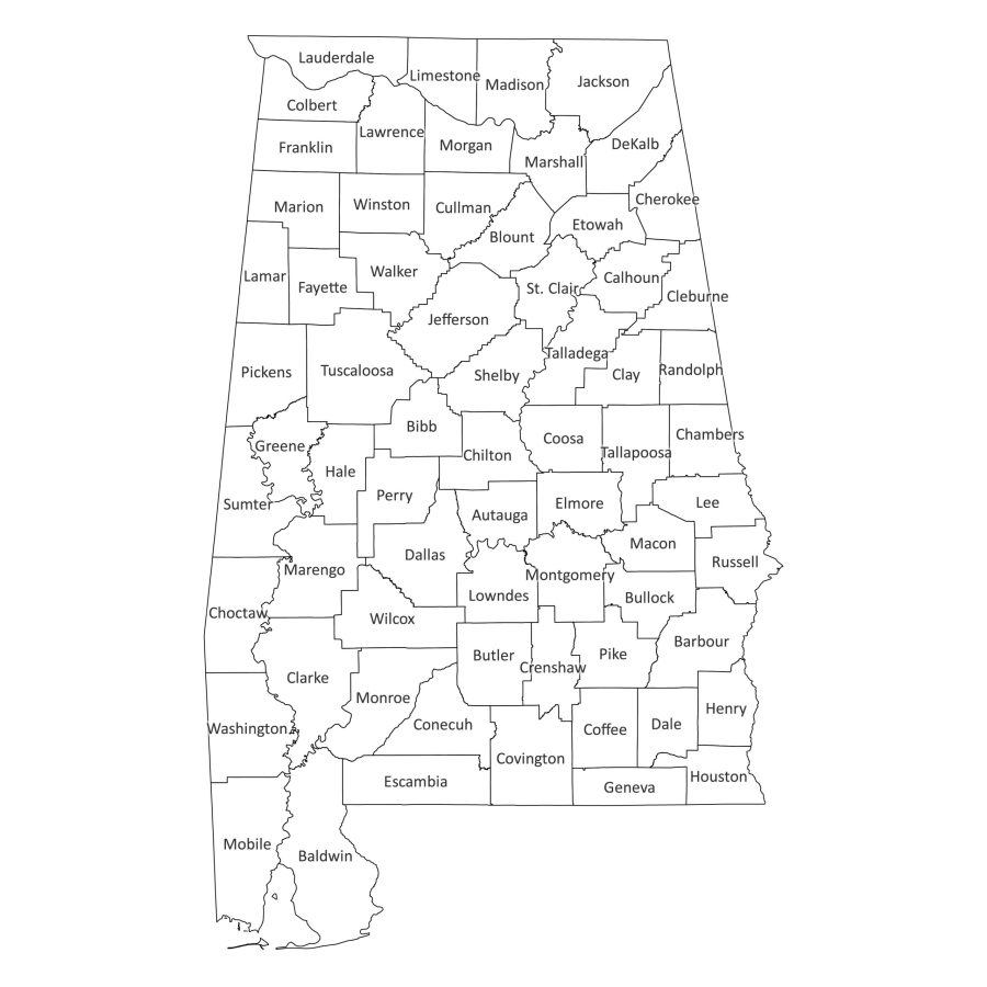
Discover the essence of Alabama with our meticulously crafted Alabama Labeled Map, a digital product that goes beyond traditional maps. Tailored for educational, research, and professional purposes, this downloadable map showcases the intricate details of Alabama’s 67 counties, providing accurate information in both black and white and colored versions.
Features of our labeled map of Alabama
Precise County Labeling
Our Alabama Labeled Map features precise labeling of all 67 counties, ensuring that you have accurate information at your fingertips. Whether you’re planning a trip, studying geography, or conducting research, the detailed labeling allows for quick and easy reference.
Multiple Formats for Flexibility
We understand that different projects may require different formats. That’s why our Alabama Labeled Map is available in a variety of file formats, all conveniently bundled in a zip file. Choose from PDF, JPG, SVG, and AI formats to seamlessly integrate the map into your projects, presentations, or educational materials.
Black and White or Colored Versions
Tailor the map to suit your preferences or project requirements. The Alabama Labeled Map is available in both black and white and colored versions, providing you with the flexibility to choose the style that best fits your needs. Whether you prefer a classic look or a vibrant representation, we’ve got you covered.
Alabama counties in Alphabetical order
Alabama is home to 67 counties, each with its own story and significance. Here’s a list of the counties included in our Alabama Labeled Map:
- Autauga
- Baldwin
- Barbour
- Bibb
- Blount
- Bullock
- Butler
- Calhoun
- Chambers
- Cherokee
- Chilton
- Choctaw
- Clarke
- Clay
- Cleburne
- Coffee
- Colbert
- Conecuh
- Coosa
- Covington
- Crenshaw
- Cullman
- Dale
- Dallas
- DeKalb
- Elmore
- Escambia
- Etowah
- Fayette
- Franklin
- Geneva
- Greene
- Hale
- Henry
- Houston
- Jackson
- Jefferson
- Lamar
- Lauderdale
- Lawrence
- Lee
- Limestone
- Lowndes
- Macon
- Madison
- Marengo
- Marion
- Marshall
- Mobile
- Monroe
- Montgomery
- Morgan
- Perry
- Pickens
- Pike
- Randolph
- Russell
- St. Clair
- Shelby
- Sumter
- Talladega
- Tallapoosa
- Tuscaloosa
- Walker
- Washington
- Wilcox
- Winston
Versatile File Formats for Maximum Flexibility
PDF: Portable and Print-Ready
The PDF format ensures portability and print readiness. Ideal for educational materials, presentations, or personal reference, the PDF version allows you to explore the map offline and in any size you desire.
JPG: High-Quality Image
For projects requiring high-quality images, our map is available in JPG format. This format guarantees clarity and precision, making the map suitable for digital presentations, websites, or any platform where image quality is paramount.
SVG: Scalable Vector Graphics
The SVG format provides infinite scalability without compromising quality. Whether you need a small icon or a large banner, our map adapts seamlessly to any size without loss of detail, making it perfect for digital designs.
AI: Editable Vector Graphics
For those seeking complete customization control, the AI (Adobe Illustrator) format is included. Modify the map to fit your specific needs, adjusting colors, labels, or adding additional information seamlessly.
Download Alabama labeled map today
Elevate your digital geography experience with our Alabama Labeled Map. Tailored for educational, research, and professional use, this digital product provides a precise overview of Alabama’s 67 counties. Download the map today and unlock a wealth of information that goes beyond traditional mapping, empowering you to delve into the heart of Alabama’s geographical intricacies with accuracy and ease.

vincent –
helped me in school
Valentino –
This is nice, got me a 100% in school 10/10, def recommend, LOLZ X3