| Formats | JPG, PDF, SVG, AI |
| Resolution | 300dpi |
| Dimensions | 300dpi: 5000 x 3750 px |
| Version | 1.1 |
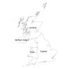
Looking for a labeled map of the United Kingdom? Look no further!
About our Map
Available in Multiple File Formats
Our labeled map of the United Kingdom is available in a variety of file formats, including PDF, JPG, SVG, and AI, bundled in a zip file for easy download. This means you can choose the format that works best for you and your needs, whether you need to print the map or use it digitally
Come in Black and White and Colored Versions
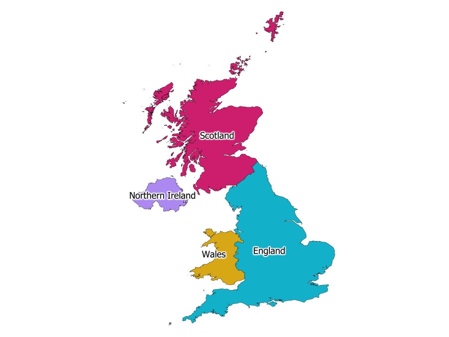
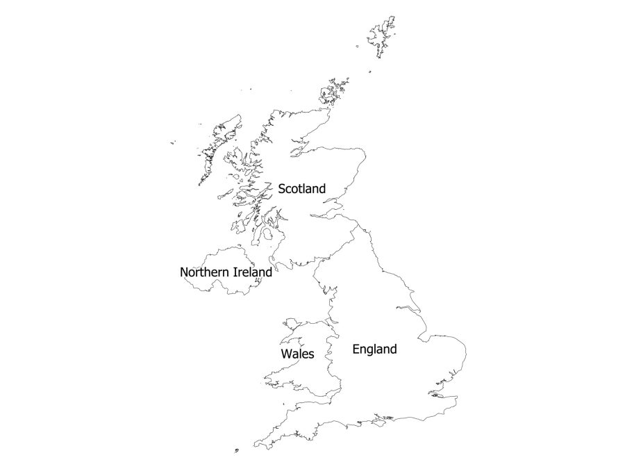
Our labeled map of the United Kingdom is available in both black and white and colored versions, so you can choose the version that best suits your needs. The black and white version is perfect for printing, while the colored version is ideal for digital use. Both versions of the map are included in the download, so you can choose the one that best meets your needs.
How to download the labeled map of United Kingdom
Downloading our labeled map of the United Kingdom is quick and easy!
- Add the map to your cart and proceed to checkout.
- Enter your payment information and complete the purchase.
- Once your purchase is complete, you’ll receive instructions on how to access your account on the website.
- Once in your account, head over to the “downloads” tab and click on the link to download the map, and the file will be saved to your device.
- Then you can proceed to extract the downloaded zip file.
And that’s it! In just a few simple steps, you can have our labeled map of the United Kingdom downloaded and ready to use.
About the United Kingdom
Location of UK on the World Map
The United Kingdom is located in northwestern Europe. The UK is bordered by the Atlantic Ocean to the west and north, the North Sea to the east, and the English Channel to the south. The coordinates of the United Kingdom are approximately 54.2361° N, 2.5486° W for the northernmost point of Scotland, and 49.6742° N, 6.1528° W for the southwesternmost point of Cornwall, England.
Constituent Countries of the United Kingdom
The United Kingdom is made up of four constituent countries: England, Scotland, Wales, and Northern Ireland. Our labeled map of the UK clearly shows the borders and labels of these four countries.
The countries of the UK further divide into different administrative entities: England divides into nine regions, Scotland into 32 council areas, Wales into 22 unitary authorities, and Northern Ireland into 11 districts.
Size and Population of UK
The United Kingdom is a relatively small country, with a total area of approximately 244,500 square kilometers. However, despite its small size, the UK has a relatively large population, with over 66 million people living there.
UK Official Language
English serves as the official language of the United Kingdom. In addition, several other languages, including Welsh, Gaelic, and Cornish, are spoken across the country.
Is United Kingdom Labeled Map Editable?
Yes, the labeled map is editable. The map is available in SVG and AI which are all editable file formats. You can use any vector graphics editor software, such as Adobe Illustrator or Inkscape, to edit the map according to your needs. For example, you can change the colors, add new labels or remove existing ones, resize or crop the map, and more. However, please note that the extent to which you can edit the map will depend on your skills and the software you use.
Reviews
There are no reviews yet