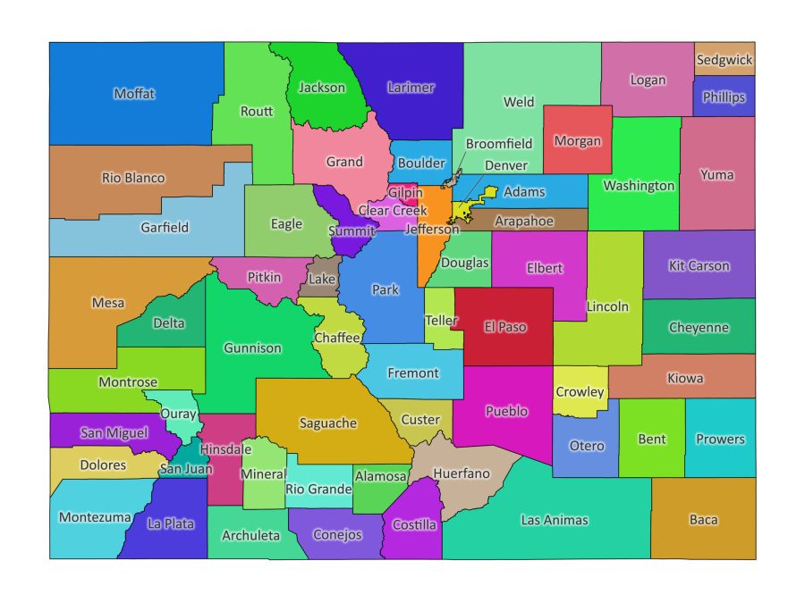
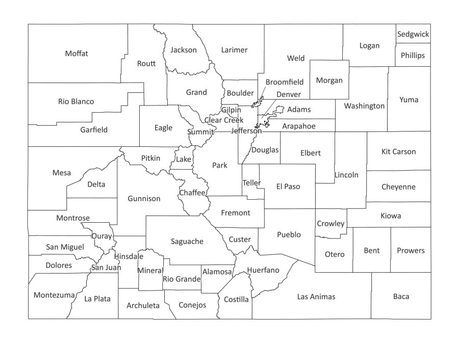
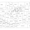
Our Colorado labeled map is an essential tool for gaining insights into the counties that make up the Centennial State. Whether you’re a student, researcher, or business owner, this downloadable labeled map provides an in-depth perspective on Colorado’s counties. Available in both black and white and vibrant colored versions, this digital product is designed to meet your informational needs.
Features of our Labeled Map
1. High-Quality Detailing:
Our labeled map of Colorado boasts high-quality detailing, offering an accurate portrayal of the state’s counties—your go-to resource for a Colorado county map.
2. Versatile Color Options:
Choose between a classic black and white aesthetic or a colorful rendition of the map to suit your preferences.
3. Multiple File Formats:
The map is available in various file formats, including PDF, JPG, PNG, SVG, and AI, bundled together in a convenient zip file.
4. Ease of Download:
The download process is seamless, ensuring quick access to all versions of the map.
Why Download the Labeled Map of Colorado?
Educational Resource:
For students and educators, this labeled map serves as an invaluable educational resource. Use it to enhance your lessons, presentations, or assignments related to Colorado’s counties.
Insights into Colorado’s Diversity:
Gain a comprehensive understanding of Colorado’s diverse counties, each with its unique characteristics and features.
Publication Resource:
For publishers and content creators, our labeled map serves as a valuable resource for articles, reports, and publications, ensuring accurate and visually appealing representations of Colorado’s counties.
File Formats Available
Ideal for high-quality prints and presentations.
JPG and PNG
Perfect for digital use, including websites and online presentations.
SVG
A scalable vector format, allowing you to resize without loss of quality. This format is perfect for those seeking a scalable Colorado county map.
AI (Adobe Illustrator):
For advanced editing and customization—an excellent option for those desiring an editable Colorado map.
About Colorado
Colorado, located in the Rocky Mountain region, boasts diverse landscapes, from towering peaks to expansive plains. Known for its outdoor pursuits, the state offers world-class skiing, hiking, and vibrant urban centers like Denver. With a rich cultural tapestry and a strong focus on sustainability, Colorado captivates residents and visitors alike.
List of Counties in Colorado
The State of Colorado is made up of 64 counties. Here is a list in alphabetical order:
- Adams
- Alamosa
- Arapahoe
- Archuleta
- Baca
- Bent
- Boulder
- Broomfield
- Chaffee
- Cheyenne
- Clear Creek
- Conejos
- Costilla
- Crowley
- Custer
- Delta
- Denver
- Dolores
- Douglas
- Eagle
- Elbert
- El Paso
- Fremont
- Garfield
- Gilpin
- Grand
- Gunnison
- Hinsdale
- Huerfano
- Jackson
- Jefferson
- Kiowa
- Kit Carson
- La Plata
- Lake
- Larimer
- Las Animas
- Lincoln
- Logan
- Mesa
- Mineral
- Moffat
- Montezuma
- Montrose
- Morgan
- Otero
- Ouray
- Park
- Phillips
- Pitkin
- Prowers
- Pueblo
- Rio Blanco
- Rio Grande
- Routt
- Saguache
- San Juan
- San Miguel
- Sedgwick
- Summit
- Teller
- Washington
- Weld
- Yuma
What is the Capital of Colorado?
The capital of Colorado is Denver. Nestled in the heart of the state, Denver serves as the political, economic, and cultural hub. As the state’s capital, Denver plays a pivotal role in Colorado’s governance and serves as a gateway to the state.
Where is Colorado on the US Map?
Located in the western part of the United States, Colorado is bordered by Wyoming to the north, Nebraska to the northeast, Kansas to the east, Oklahoma to the southeast, New Mexico to the south, Utah to the west, and Arizona to the southwest at the Four Corners region.
Major Cities in Colorado
- Denver
- Colorado Springs
- Aurora
- Fort Collins
- Lakewood
- Thornton
- Arvada
- Westminster
- Pueblo
- Centennial
Is Colorado Labeled Map Printable and Editable?
Absolutely! The labeled map of Colorado is designed for both print and digital use, ensuring versatility for your specific informational needs.
How to Edit Colorado County Map
Editing the map is simple:
- Open the SVG or AI file: Use Adobe Illustrator, Inkscape, or any vector graphic editor that supports these formats.
- Select the Element to Edit: Choose the county or element you want to modify.
- Apply Changes: Utilize the editing tools within your chosen software to make adjustments, change colors, or add labels.
- Save Your Changes: Once satisfied with your edits, save the file with a new name to preserve the original.
Gain a deeper understanding of Colorado’s counties with our labeled map—your key to exploring the diverse characteristics of the Centennial State!
Reviews
There are no reviews yet