If you’re looking for a comprehensive and accurate labeled map of South Africa, you’re in the right place.
South Africa Labeled Map comes in multiple formats
Our labeled map of South Africa is available in a variety of formats to meet your specific needs. Whether you prefer a PDF, JPG, PNG, SVG, or AI file format, we’ve got you covered. All our formats are bundled in a single zip file, making it easy to download and access the map. Additionally, all our formats are high-resolution, ensuring that you’ll always have a clear and accurate map at your fingertips. The high resolution also makes it ideal for printing.
Colored and black and white versions
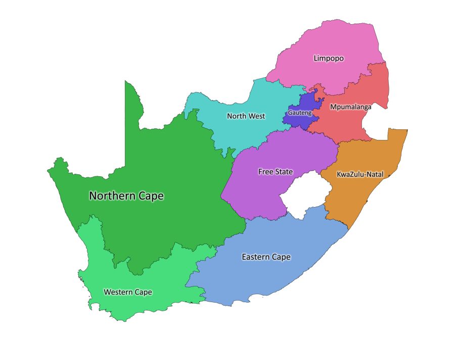
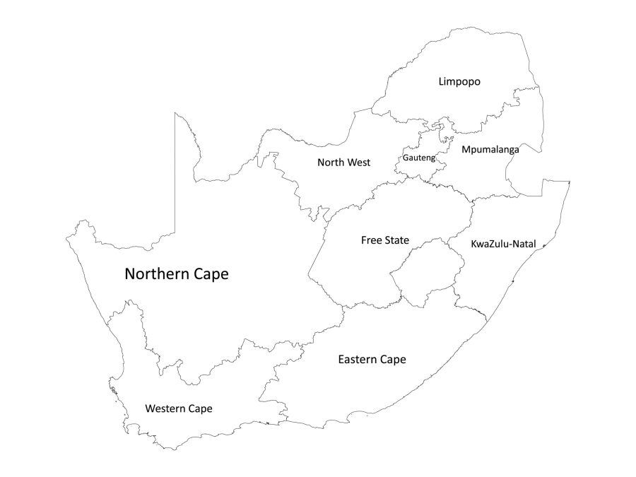
Our labeled map of South Africa is available in both colored and black and white versions, giving you the flexibility to choose the one that best suits your needs. The colored version is perfect for anyone who needs to see the map in a more visually appealing way, while the black and white version is ideal for those who need a simpler and more straightforward map.
About South Africa
Location of South Africa: Continent & Coordinates
South Africa is located at the southernmost point of the African continent and is surrounded by the Atlantic and Indian Oceans. It shares borders with six other countries and is situated in the southern hemisphere. Its coordinates are 30.5595° S, 22.9375° E.
The country’s location in the southern hemisphere means that its seasons are the opposite of those in the northern hemisphere. For example, while the northern hemisphere experiences summer from June to August, South Africa experiences winter during the same months.
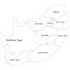
Provinces as shown in the Labeled Map of South Africa
South Africa is divided into nine provinces, each with its own government, legislature, and capital city. The provinces are:
- Eastern Cape
- Free State
- Gauteng
- KwaZulu-Natal
- Limpopo
- Mpumalanga
- North West
- Northern Cape
- Western Cape
Our map shows each province clearly, with borders and easy-to-read labels. With this map, you’ll be able to identify and distinguish each province quickly and easily.
South Africa’s neighboring countries
South Africa shares borders with six countries namely:
- Namibia to the northwest
- Botswana to the north
- Zimbabwe to the northeast
- Eswatini to the east
- Mozambique to the northeast
- Lesotho, an enclave entirely surrounded by South Africa, in the east
South Africa’s official language
South Africa has eleven official languages recognized by its constitution. They are:
- isiZulu
- isiXhosa
- Afrikaans
- English
- Sepedi
- Setswana
- Sesotho
- Xitsonga
- siSwati
- Tshivenda
- isiNdebele
These languages are used for official communication, education, and government proceedings in various regions of South Africa, depending on their prevalence and historical significance in each area.
English is widely spoken and serves as the primary language for business and government communication. The other languages are used in different provinces, with isiZulu and isiXhosa being the most widely spoken languages in the country.
How to download our labeled map of South Africa
To download our labeled map of South Africa, simply add it to your cart and proceed to checkout. Once your purchase is complete, you’ll receive a link to access your account where you can download the zip file. Within the file, you will find all the file formats. It’s that easy!
Reviews
There are no reviews yet