About our labeled map
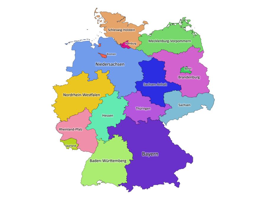
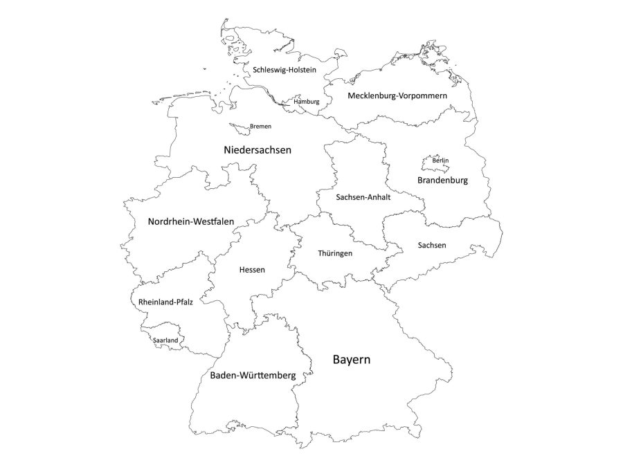
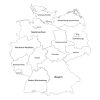
Looking for a high-quality labeled map of Germany? Look no further than our digital map – the perfect resource for anyone seeking a comprehensive and accurate representation of the country’s federal states.
Our labeled map of Germany is available in both black and white and colored versions, making it easy to choose the right style for your project, presentation, or academic needs. And with multiple file formats, including PDF, JPG, PNG, SVG, and AI, you can download and use the map in the way that works best for you.
Here are just a few of the key features and benefits of our labeled map of Germany:
Accurate and Up-to-Date Information
Our map is meticulously labeled, with each of the 16 federal states correctly marked and clearly visible. Plus, we ensure that all of our maps are up-to-date with the latest political/administrative information.
The Labeled Map of Germany comes in Multiple Formats
Whether you need a PDF, JPG, PNG, SVG, or AI version of the map, we’ve got you covered. And with all of these file formats bundled together in one zip file, you can easily switch between formats as needed.
Easy to Print and Use
Our map is designed to be easy to print and edit all thanks to the PDF and SVG files respectively. You can also use the AI file to edit and export to multiple file formats using Adobe Illustrator.
Choose Your Style
Want a black and white map for a more classic look? Or do you prefer a vibrant, colorful map that really pops? Whatever your preference, we offer both options so that you can choose the style that works best for you.
About Germany
Germany is a country located in central Europe and is bordered by Denmark to the north, Poland, and the Czech Republic to the east, Austria, and Switzerland to the south, and France, Luxembourg, Belgium, and the Netherlands to the west.
It has a total area of 357,386 square kilometers and is the seventh-largest country in Europe. The country has a diverse landscape, including forests, mountains, and rivers, which offer plenty of opportunities for tourists.
German is the official language of Germany, and it is spoken by more than 100 million people worldwide. The German language has a rich history and has contributed many words and phrases to the English language.
Common German phrases and vocabulary include “Guten Tag” (good day), “Danke” (thank you), and “Wie geht es Ihnen?” (how are you?). Many resources are available for learning German, including language courses, online tutorials, and language exchange programs.
List of the 16 Federal States of Germany
As shown on our map, Germany is divided into 16 federal states, known as Bundesländer. The states are:
- Baden-Württemberg
- Bavaria (Bayern)
- Berlin
- Brandenburg
- Bremen
- Hamburg
- Hesse (Hessen)
- Lower Saxony (Niedersachsen)
- Mecklenburg-Vorpommern
- North Rhine-Westphalia (Nordrhein-Westfalen)
- Rhineland-Palatinate (Rheinland-Pfalz)
- Saarland
- Saxony (Sachsen)
- Saxony-Anhalt (Sachsen-Anhalt)
- Schleswig-Holstein
- Thuringia (Thüringen)
How to download the labeled map of Germany
To download the labeled map of Germany:
- Add the map to your cart and proceed to checkout.
- Enter your payment and contact information and complete your purchase.
- Once your payment has been processed, you will receive an email giving you access to your account where you can download the zip file containing the map.
Reviews
There are no reviews yet